Data and communication transmission
PCRI, satellite broadcast and GIS
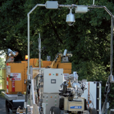
PCRI

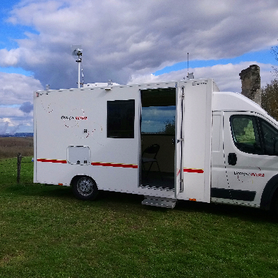
PCRI, Groupe INTRA’s Operations Team Leader’s Control Station, is located in a light utility vehicle and receives all the data coming from the equipment deployed on the damaged site. These data can be transmitted by fibre optics, coaxial cable or radio. The Operations Team Leader is the interface between the crisis/emergency management centre and the team in the field. Together with an expert from Groupe INTRA who provides technical support, he checks data quality before broadcasting to the client and analyses requests to direct and control the interventions. PCRI is based on a van body upon which a cell, divided in two sections (workstation and, equipment transport), has been fitted. The vehicule is fully energy autonomous. It includes a gas powered generator, a GSM link, radio communication with other teams working on the field, video selection and display features, a WIFI entry point and a satellite antenna. The vehicule is not designed to withstand CBRN risks due to a 3.5 tonnes gauge limitation but includes a radiological beacon system to alert in real time the team members from any environmental evolution that would warrant implementation of safety measures (donning personal protective equipment,, vehicule relocation and emergency evacuation).
Satellite links and internet connection
Groupe INTRA has two systems to broadcast data via satellite which also enable internet connection and phone line. The first system is permanently installed in the PCRI and the satellite antenna coupled with an automatic search and aiming system. The second system, normally used with the aerial drones, is portable with a manual aiming system. It is made of two modems, one for routine usage during tests and exercises without bandwidth guarantee and the other for emergency situations with a dedicated bandwidth.

Characteristics
Geographical Information System
Groupe INTRA has set up a GIS (Geographical Information System) platform to :
• Ease and reduce missions preparation time, • Simplify data collection and visualisation,
• Centralise actions within the same software, • Ensure perenniality and maintainability of the solution.
And therefore cover all needs for useful geographical data during the missions’ different phases (preparation, execution, feedback).
The platform has been designed with ESRI products (ArcGIS) which are widely used worlwide.
It consists of :
• A geographical database optimised for all other softwares,
• A desktop GIS software to manage data and prepare missions maps,
• Offline GIS applications for equipment and Operations Team Leader’s Control stations,
• Online services and web application for crisis/emergency management organisations with direct access by login and
password provided by the Operations Team Leader.
Snapshots of

Snapshots of the web site